
Photogrammetry Applications in Aerial Photography
PhotoModeler Technologies’ photogrammetry software obviously has a wide variety of real-world applications, not the least of which is in aerial photography as performed by drones and other kinds of UAVs (unmanned aerial vehicles). Aerial Photography in Industry Land Surveying Disaster Relief Cartography Public Safety How Aerial Photogrammetry Applies Photo Triangulation Advantages of Aerial Photogrammetry UAVs […]
PhotoModeler 2018.1 Release and Drone Vertical Datums
PhotoModeler Release PhotoModeler version 2018.1.0 was released April 11th, 2018. It has a number of large and small improvements and fixes. UAV Control Marking Improvement. UAV and drone projects with GCP (ground control points) are now easier to set up. Multi-point Transform Improvement. Multi-point transforms can now be formed with just one point assigned (translate), […]
Why use Photogrammetry for Surveying and Mapping?
Photogrammetry has a long history of use in the surveying and mapping field. Photogrammetry can be used for point measurements or for generating point clouds. Compared to its chief rival, LiDAR (Laser Imaging, Detection and Ranging), point-cloud generation from photogrammetry is cost-effective, portable, and versatile, so it has always had a loyal following among practitioners. […]
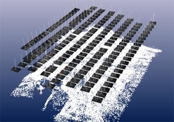
With a Camera and a Drone Audit a Mine Reclamation
Mining companies are often required to restore mine sites to economically usable conditions after extracting minerals. This process, usually referred to as mine reclamation, involves rehabilitation and other processes that minimize the environmental impact of mining. The reclaimed land can be used for agricultural, recreational, commercial, and residential uses. An audit of the reclaimed site […]
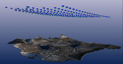
Survey Grade Accuracy with a Drone without Ground Control !
To get high accuracy with a drone photo-based survey, one usually needs to place and survey ground control points. Ground control points are either man-made targets (e.g. large cross) that you place on the ground before the flight, or visible natural features, surveyed with a high accuracy instrument (total station or RTK GPS). To achieve […]
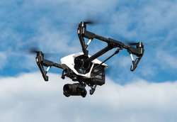
UAS / UAV Photography for 3D Scanning, Measurement and Modeling
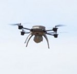
With the proliferation of UAS/UAV (unmanned aircraft systems, unmanned aerial vehicles, or drones) armed with lightweight cameras it has become much easier to capture, scan, measure and 3D model scenes from above. The technique is called photogrammetry. You no longer need to hire an airplane to take aerial photos or purchase expensive aerial photos of […]
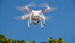
Tip 26: Create an UAV ortho-photo mosaic in PhotoModeler
UAVs (Unmanned Aerial Vehicles) and drones are big news these days, not only in military use but more so with many new commercial and public safety applications. With cost-effective fixed-wing and multi-rotor UAVs capable of carrying camera payloads coming on the market, the sky has literally been opened to new possibilities! Aerial photogrammetry was once […]