
PhotoModeler 2018.1 Release and Drone Vertical Datums
PhotoModeler Release PhotoModeler version 2018.1.0 was released April 11th, 2018. It has a number of large and small improvements and fixes. UAV Control Marking Improvement. UAV and drone projects with GCP (ground control points) are now easier to set up. Multi-point Transform Improvement. Multi-point transforms can now be formed with just one point assigned (translate), […]
Why use Photogrammetry for Surveying and Mapping?
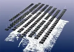
Photogrammetry has a long history of use in the surveying and mapping field. Photogrammetry can be used for point measurements or for generating point clouds. Compared to its chief rival, LiDAR (Laser Imaging, Detection and Ranging), point-cloud generation from photogrammetry is cost-effective, portable, and versatile, so it has always had a loyal following among practitioners. […]
The Other Photogrammetry Automation – Coded Targets
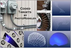
What are Coded Targets? Automation History Why Use Coded Targets? Coded Targets vs Smart Points Coded Target Examples and Applications What are Coded Targets? I am sure you’ve seen a bar code on product packaging. Bar codes are scanned by a laser that reads the pattern of white and black bars, and converts that into […]
Capturing BIM Data: An Affordable Alternative to Laser Scanning

BIM and the Importance of Image Processing BIM is the process of designing a building collaboratively with just one coherent system of 3D computer models, rather than multiple sets of separate diagrams. This leads to huge savings in time and resources, more accurate estimation, and fewer mistakes and alterations due to loss of data. BIM […]
With a Camera Measure, Monitor, and Document Bridges
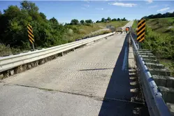
The process of monitoring the health of bridges demands reliable measurement techniques. Traditional methods of monitoring the conditions of bridges are disruptive and may cause inconvenience to users. In addition, the approaches are labor-intensive, and the results are usually less accurate. Considering that there are many transportation structures that require routine monitoring, it is a […]
With a Camera and a Drone Audit a Mine Reclamation

Mining companies are often required to restore mine sites to economically usable conditions after extracting minerals. This process, usually referred to as mine reclamation, involves rehabilitation and other processes that minimize the environmental impact of mining. The reclaimed land can be used for agricultural, recreational, commercial, and residential uses. An audit of the reclaimed site […]
With A Camera Perform Accurate and Detailed Surveying
Surveying is an essential process in mapping, mining, construction, and architecture. This time and labor intensive process involves using a wide range of traditional and modern equipment to obtain measurements. Depending on the nature of the task, the required accuracy, and the challenges involved, a surveyor can use a tape measure/roller, a total station, a […]
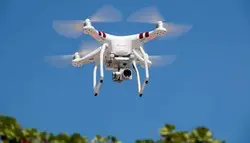
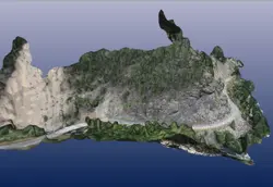
Survey Grade Accuracy with a Drone without Ground Control !
To get high accuracy with a drone photo-based survey, one usually needs to place and survey ground control points. Ground control points are either man-made targets (e.g. large cross) that you place on the ground before the flight, or visible natural features, surveyed with a high accuracy instrument (total station or RTK GPS). To achieve […]
Tip 72: Exporting a 3D model for use in Google Earth

Did you know that 3D models created in PhotoModeler can be transfered to Google Earth? If your model has a geographic coordinate system set up it can be exported from PhotoModeler in the .kmz format and viewed in Google Earth. It’s a great way to share your models with colleagues, friends, or the Google Earth […]
Tip 67: Two ways to use external XYZ data in PhotoModeler

External 3D XYZ point data can be imported into PhotoModeler and used in a few different ways. This tip video describes the two most common uses: multi-point transforms, and control points. External XYZ data can be supplied by other measurement devices, such as survey total stations, GIS, laser scanners, or other photogrammetry projects. This data, […]