PhotoModeler 2018.0 Release Improvements

The most significant improvements in PhotoModeler 2018.0 span the needs of a wide range of our customers:
- New Gridded Digital Elevation Model Export
- Smart Processing now for Coded Target Projects
- Smart Processing speed increase for large projects
- Orthophoto improvements
Gridded DEM Export
PhotoModeler has exported triangulated surface models for many years. It is common though, with GIS and geographic-based systems that deal with 2.5D surfaces (2D plus height), to represent a surface as a DEM (Digital Elevation Model). Typically, a DEM is a regular grid of cells, each with a height value.
PhotoModeler UAS 2018.0 adds the ability to export gridded DEMs when creating orthophotos. You can think of the gridded DEM being directly related to the orthophoto. They are based on the same projection plane and axis alignment. The orthophoto has an RGB color per cell, and the DEM has a height per cell. Exported DEMs can also have full geographic information to place them accurately in the world.
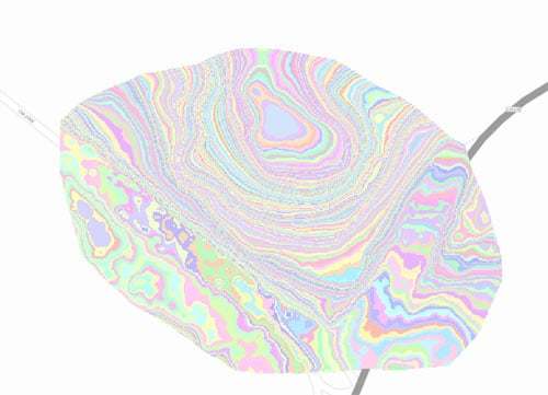
Gridded DEMs can be exported as sparse XYZ text files, or as GeoTIFF files (16-bit integer or 32-bit float). Several applications such as ArcGIS, GlobalMapper, QGIS, 4dmapper.com, Agtek Earthworks, and Google Earth can import PhotoModeler’s gridded DEM and orthophoto products. Here is a view of the UAS tutorial DEM in ArgGIS:

Smart Processing Improvements
Smart Processing (the ability to solve for camera positions and 3D data in the presence of mis-matches and noise) has been in PhotoModeler for automated Smart Point projects for several years. With the 2018.0 release, all Coded Target projects are now processed with an improved version of Smart Processing as well. This makes Coded Target projects easier and faster to set up and use. Mis-coded target points no longer cause headaches. Applies to all PhotoModeler versions. There will be an upcoming article discussing the benefits and uses of Coded Targets. Watch this space! Below is a Coded Target project accurately measuring a staircase.

Smart Processing Speed Increase
Other improvements to the Smart Processing algorithm have resulted in some significant speed increases – esp. for bigger projects (over 100 photos). The time to orient large projects is an important aspect of productivity. In some cases, you can see 2 to 4 times decrease in time to orient the photos. Applies to PhotoModeler Scanner and UAS only.
Orthophoto Improvements
There are 6 small improvements in the export of orthophotos / orthomosaics:
- The Export Orthophoto dialog now shows the range and average ground pixel size of all the input photos,
- The dialog also shows the computed output pixel size,
- The dialog has a new control for setting the scale of the output based on pixel size (for those that want a particular object or ground real pixel size, or want to match the input pixel size – using the value from 1.),
- The output orthophoto now has an embedded scale bar (optional),
- GeoTIFF files now have embedded units (good for exporting USFeet systems for example), and
- GeoTIFF files can be exported for non-geographic projects.
Getting the new release
If you are an existing customer you can use ‘Check for Updates’ in your software. If you are using a demo or an evaluation version, you can download the latest.
