Survey Grade Accuracy with a Drone without Ground Control !

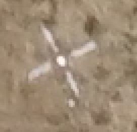
Ground Control Point seen from drone camera
To get high accuracy with a drone photo-based survey, one usually needs to place and survey ground control points. Ground control points are either man-made targets (e.g. large cross) that you place on the ground before the flight, or visible natural features, surveyed with a high accuracy instrument (total station or RTK GPS).
To achieve 2 cm to 4 cm ground accuracy from your drone survey over the whole area usually requires 10 or more ground control points. These ground control points (GCPs) require travel over the whole site, take time to place, survey, and optionally remove, and thus are an expensive method. Any way to reduce ground control requirements is money and time in your pocket!
How can you reduce the number of ground control points or remove them completely? You can do that by knowing where you drone was to high accuracy during the flight and for each photograph. Most drones have a built-in GPS (and IMU + barometric altimeter) for navigation but the positional data (esp. in an absolute sense) is not that accurate. A photo-based survey carried out with a modern drone, with its own GPS/ positional data, will be in roughly the correct part of the world and its relative accuracy will be reasonable but its absolute accuracy may be good only to around 5 m to 10 m. On the other hand, if you know where the drone is during photography to high accuracy you can achieve much higher ground survey accuracy.
The way to do that is using a differential method for the drone GPS/GNSS receiver. RTK and PPK (Real Time Kinematics and Post Processed Kinematics) GNSS are the ways to do that. For this application, PPK is often superior because real time position is not required, and PPK requires no radio link so it is more reliable and works over greater distances than RTK. In addition, more processing power can be applied to the PPK position solutions since the processing is done back at the office on your computer and not on a smaller GNSS receiver.

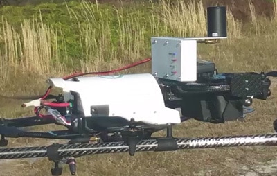
PPK Receiver (white box with black antenna) mounted on drone above camera.
The PhotoModeler UAS product supports PPK and RTK systems that lets you reduce or remove the requirements for ground control. Imagine the cost and time savings when you are doing accurate surveys using your drone! When you return from your flight you load the photos from the drone camera, the data from the drone PPK unit, and the data from the base station into PhotoModeler UAS and hit process. The result is a highly accurate ground survey in the form of a point cloud, or optionally a dense mesh, contours, 3D file export, or an orthophoto.
Here are some results from a real-world test with a KG PPK unit and processed with PhotoModeler UAS. The goal of this test was to see how accurate a survey without ground control could be. The camera and system were first calibrated. A new project was started without any ground control and using just the PPK camera position data as external input. The ground control points were then imported but to be used only as check points. The control points did not affect the adjustment or processing (they were imported after the processing) but instead could be used just to compare the solved 3D locations of those points with the external data as a ‘check’. The ground control points were marked on the photos so that PhotoModeler UAS could compute their 3D location (using just the previously solved camera positions and camera calibration), and a report was generated.
Here are the results of the check of 9 ground control points:

The RMS error, which is similar to the one sigma precision, shows an error of approx. 2 cm in Northing and Easting and 6 cm in elevation. This is survey grade accuracy using no ground control points in the solution! The elevation error could probably be improved further using one or two ground control points if that was important (you could even use the drone after landing to do that). Here is a link to the full PPK PDF Report generated by PhotoModeler UAS for this project.
